Water Management Data System Menu
Addicks and Barker Reservoirs Flood Control Projects
Addicks and Barker Reservoirs are located approximately 17 miles west of downtown Houston, in the San Jacinto River basin(see map below). Both Reservoirs are mainly used for flood risk management. The reservoirs also provide recreational benefits and limited habitat for wildlife.
Most of Addicks and Barker Reservoirs lie within Harris County, but a small portion of Barker Reservoir extends into Fort Bend County. Addicks Reservoir is located on the north side of Interstate Highway 10 (IH-10) with State Highway 6 (SH 6) and Eldridge Parkway roughly dividing the reservoir into thirds. Barker Reservoir is located on the south side of IH-10, and west of SH 6.
Addicks and Barker Reservoirs provide flood control only and do not maintain permanent pools. Releases from both dams merge and flow downstream on the Buffalo Bayou stream through the City of Houston and into the Houston Ship Channel.
Location of Addicks and Barker Reservoirs West of
Houston, TX.
Addicks Reservoir is in the North of IH-10 and Barker reservoir is in the South Side.
Select layer from the Layer Control Insert to add layer data to map.
Click on each reservoir to display its information.
Addicks Reservoir watershed is bounded by West Little York Road on the north, West Beltway 8 on the east, IH 10 on the south, and Barker Cypress Road on the west. SH 6 bisects the reservoir from north to south.
Addicks dam is located on South Mayde Creek,approximately 1 mile above the confluence with Buffalo Bayou. The watershed is roughly 15 miles long, 10 miles wide, and has a drainage area of approximately 136 square miles. Natural ground elevations in the basin vary from about 197 feet North American Vertical Datum of 1988 (NAVD88) at the upstream divide to 68 feet NAVD88 at Addicks Dam.
The main inflow contributors to Addicks Reservoir are South Mayde Creek, Bear Creek,and their tributaries Horsepen Creek, Dinner Creek, and Langham Creek. During large events, Cypress Creek will overflow into Addicks reservoir.
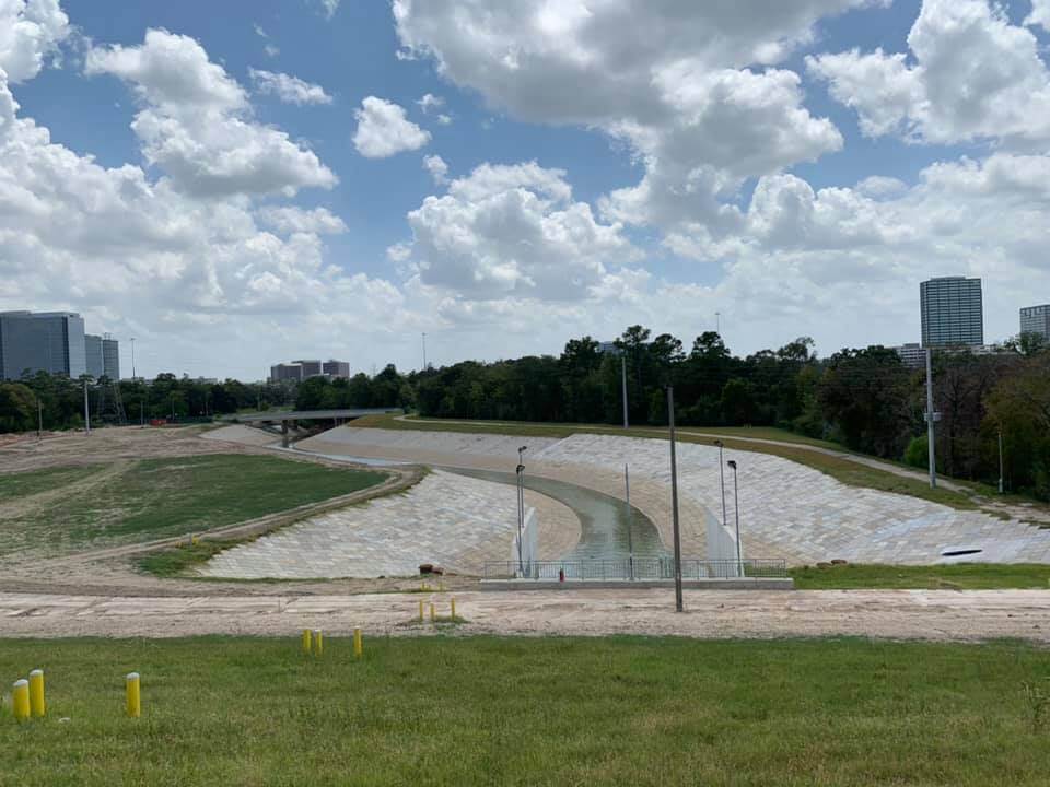
Barker Reservoir watershed is located on Buffalo Bayou, approximately 0.2 miles upstream of SH 6. This watershed is adjacent and south of the Addicks Reservoir watershed. Outflows from Barker Reservoir together with outflows from Addicks Reservoir are monitored downstream at Piney Point, approximately 11 miles downstream from Barker Dam.
Barker Reservoir watershed is bounded by IH 10 on the north, SH 6 on the east, Westpark Tollway on the south, and Grand Parkway on the west. Barker Reservoir watershed consists of Buffalo Bayou above Barker Dam and lies within Harris, Waller, and Fort Bend Counties.
The watershed is a roughly trapezoidal area of approximately 130 square miles, is about 23 miles long with an average width of some 6 miles. Natural ground elevations vary from about 197 feet NAVD88 at the upstream divide to about 70 feet NAVD88 at Barker Dam. Natural streamflow gradients in the basin are uniform at about 5 feet per mile sloping in a southerly direction.
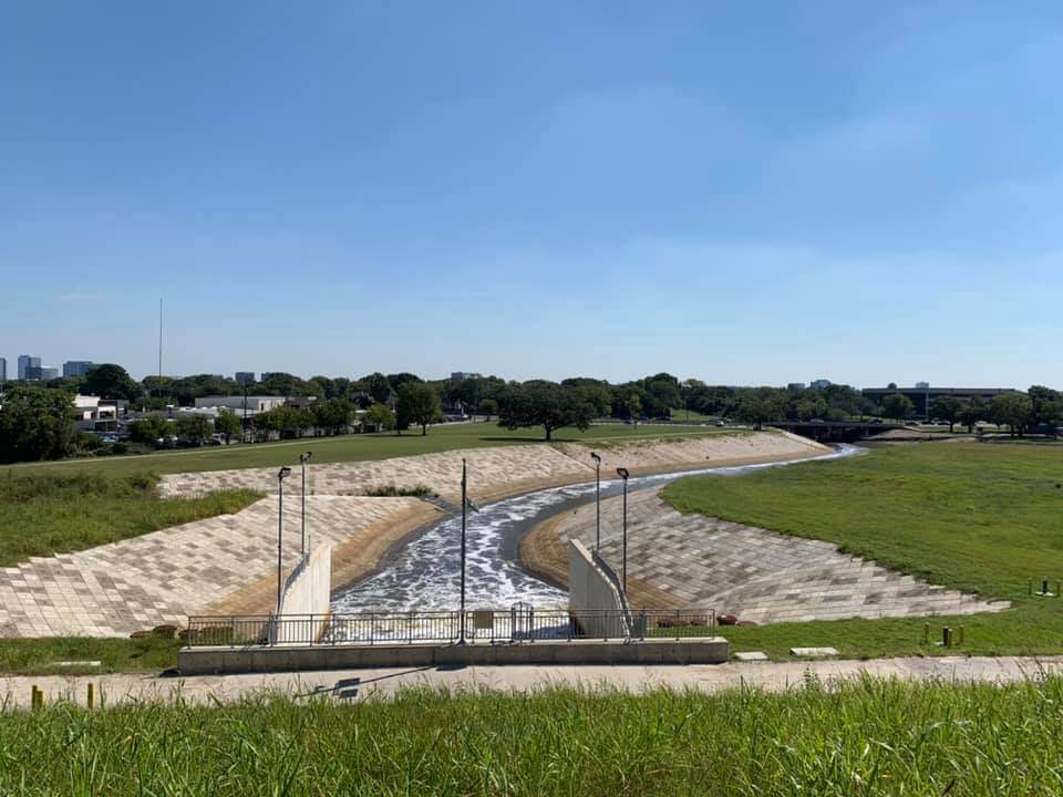
Buffalo Bayou is a tributary of the San Jacinto River. The Buffalo Bayou watershed lies primarily in Harris and Fort Bend Counties in southeast Texas. The basin is bounded on the north by Cypress Creek, on the east by the San Jacinto River, on the south by Clear Creek, and on the west by the Brazos River. Barker Dam is located on Buffalo Bayou about 1000 feet upstream of SH 6.
Cypress Creek watershed is a one hundred and thirty square miles watershed, upstream of US Highway 290. This portion lies north of and adjacent to the Addicks Reservoir watershed. The general land slope of Harris and Waller Counties in this area is in a southerly direction while the Cypress Creek Channel flows in an easterly direction to its confluence with Spring Creek in eastern Harris County. Consequently, the poorly defined divide to the south allows floodwaters from the larger floods to flow southward across the divide into the on the Addicks Reservoir watershed. The overflows vary depending intensity of the storms and their centering.
Summary of Pertinent Data
| Item | Addicks Reservoir | Barker Reservoir |
|---|---|---|
| Drainage Area | 136 square miles | 130 square miles |
| Dam Height(above Stream bed) | 48.5 feet NAVD88 | 36.5 feet NAVD88 |
| Elevation Limit of Government Owned Land | 103 feet NAVD88 | 95 feet NAVD88 |
| 100 yr Flood Elevation | 103.8 feet NAVD88 | 97 feet NAVD88 |
| Standard Project Flood | 107.6 feet NAVD88 | 98.3 feet NAVD88 |
| Natural Ground at end of Dam | 108 feet NAVD88 | 104 feet NAVD88 |
| Top of Dam | 121 feet NAVD88 | 113.1 feet NAVD88 |
| Conduits | 3-gated Steel line conduits encased by concrete | 3-gated Steel line conduits encased by concrete |
More information and data can be found at : Addicks and Barker Water Control Manual
Operation of Addicks and Barker Reservoirs: an Overview
When the reservoirs are basically dry, Addicks Project
Office personnel monitor the middle portion of each dam
and the outlet structures daily, five days a week.
Once a week, project personnel survey the whole dam
from end to end and take piezometer readings.
The outlet structures are monitored three times a day,
7 days a week. Once a week, project personnel survey the
entire dam from end to end where the dams tie into
natural ground. Piezometer readings are taken more
frequently.
Periodic inspections (required by regulations) are
done where people will walk the inner toe, outer toe and
top of the dam embankments and inspect the outlet
structures. Once every five years this inspection and a
risk assessment of the dams is also done.
Water Control Manual-Addicks & Barker
The Water Control manual that is currently used for
operation of Addicks and Barker reservoirs is available at:
Addicks and Barker Water Control Manual
Frequently Asked Questions-Addicks and Barker Standard Operations
What are the Addicks and Barker Dams and Reservoirs?
In response to devastating floods that occurred in Houston in 1929 and 1935, the U.S. Army Corps of Engineers Galveston District began construction of Addicks and Barker Dams in what was then undeveloped areas in far west Harris and east Fort Bend counties. This was to prevent the loss of life and property and provide flood damage reduction along Buffalo Bayou downstream of the reservoirs and through the center of the City of Houston. Construction of the Addicks and Barker structures were completed in 1948 and 1945 respectively.
Where are Addicks and Barker dams located?
The
Addicks and Barker Dams
and Reservoirs are in southeast Texas in the San
Jacinto River basin approximately 17 miles west of
downtown Houston. The reservoirs are strategically
located above the confluence of Buffalo Bayou and
South Mayde Creek. The majority of both Addicks and
Barker structures fall within Harris County, however,
a small portion of the Barker Reservoir crosses into
Fort Bend County. The structures are located near the
intersection of Interstate Highway 10 and State
Highway 6, with the Addicks Reservoir located north of
I-10 and the Barker facility located south of I-10.
When the reservoirs are empty and there’s no rain, gates at both reservoirs are generally kept open to allow the free flow of water through the outlet works structures. When a rain event occurs, the gates are closed on the Addicks and Barker dams to reduce flooding below the reservoirs. During normal conditions, when the downstream flow at the Piney Point regulating gage has receded below 2,000 cubic feet per second (cfs) or approved deviation, the gates are reopened, and water is released at a controlled rate. In extraordinary circumstances such as extreme storms, the water control manual may also require releases while it is still flooding downstream.
How much water is released from the dams and reservoirs?When releasing water, the combined outflows from the structures plus downstream inflows are limited to 2,000 cubic feet per second (cfs) at the Piney Point regulating gage. During recent years, deviations to the water control manual have been granted during construction to increase that limit to 4,000 cfs. In extraordinary circumstances such as extreme storms, the water control manual may also require releases while it is still flooding downstream.
Are releases ever made during a storm event?Under normal conditions, releases will not be made during a storm event. During extraordinary circumstances, when the pool elevation is already high and continues to rapidly rise, releases may be required, following the water control manual, while it is still flooding downstream. These releases are also known as induced surcharge releases. Releases are possible at either Addicks Reservoir or Barker Reservoir or both reservoirs. The Addicks and Barker Water Control Manual outlines the conditions that must be satisfied before surcharge releases are allowed.
- The pool elevation in Addicks must be at least Elevation 101.
- The pool elevation in Barker must be at least Elevation 95.7.
- In addition, the rate at which the pool is rising must exceed specific levels depending upon the pool elevation.
The primary purpose of the induced surcharge operation is to "protect the dam without making the downstream flooding worse than if the dam were never there".
Why do the dams have emergency spillways?The Addicks and Barker spillways are located at the north and south ends of the Addicks and Barker embankments. In contrast to the dam, the emergency spillway is concrete. Spillways allow for the passage of water over or around a dam when the reservoir is full so that the dam is not damaged by the erosive effects of water overtopping the main embankment. Even during Hurricane Harvey, in which the volume stored was nearly twice that of any previous storms, the emergency spillway was still not activated.
Where can I learn more about USACE Addicks and Barker Dam Safety Program?
Learn more about the Addicks and Barker Dam Safety
Program:
1:
Galveston District Dam Safety Program
2:
Water Management Dam Safety Page
